NWS Warns of Scattered Thunderstorms, Flash Flood Hazards and Gusty Outflows Across Southern Nevada
By TheNevadaGlobeStaff, September 21, 2026 11:40 am
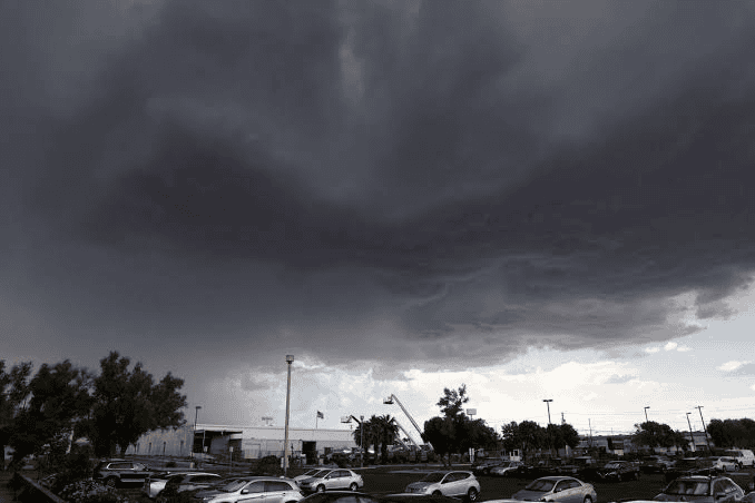
LAS VEGAS, NV — The National Weather Service (NWS) Las Vegas has issued a hazardous weather outlook warning of isolated to scattered thunderstorms, localized cloudbursts, and sudden downburst winds impacting Clark County and the surrounding Great Basin passes.
The late-season weather pattern—driven by a surge of subtropical monsoonal moisture interacting with an upper-level low moving inland from the California coast—presents elevated flash-flooding potential along regional washes, low-lying intersections, and burn scars through midweek.
+--------------------------------------------------------+
|       SOUTHERN NEVADA THUNDERSTORM & FLOOD DOSSIER     |
+--------------------------------------------------------+
|  - Issuing Office: National Weather Service Las Vegas  |
|  - Active Threat Window: Mid-September Convective Run  |
|  - Primary Hazards: Localized Flash Flooding, Cloud-to-|
|    Ground Lightning, Sudden Outflow Winds (Up to 45 mph)|
|  - Key Atmospheric Drivers: Subtropical Moisture Plume |
|    Colliding with Pacific Low & High Desert Heating    |
|  - Focus Sectors: Spring Mountains, Sheep Range, I-15  |
|    Corridor, Muddy & Virgin River Basins, Urban Washes |
|  - Infrastructure Alert: Clark County Regional Flood   |
|    Control District (RFCD) Detention Basins Primed     |
|  - Driver Guidance: "Turn Around, Don't Drown" Rules   |
+--------------------------------------------------------+
Atmospheric Dynamics and High-Desert Instability
According to atmospheric soundings released by meteorologists at the Las Vegas forecast office, precipitable water (PW) values have climbed toward 1.0 inch across the desert interior, providing sufficient convective fuel when paired with daytime surface temperatures.
While the strongest upper-level dynamics and convective coverage remain centered across the higher terrain of Inyo, Nye, and Lincoln counties, high-resolution predictive models indicate strong localized storms can quickly fire along the Spring Mountains and Sheep Range.
When these mountain cells mature, intense downdrafts can push dense outflow boundaries southward across the valley floor.
These outflow winds—capable of generating sudden gusts between 35 and 45 mph—can loft desert dust, suddenly drop visibility along arterial corridors, and trigger secondary thunderstorm cells over the urban core.
Urban Runoff and Regional Flood Controls
The primary public safety risk in the Las Vegas metropolitan area remains localized flash flooding.
Because the Mojave Desert’s hard-packed caliche soil and urban asphalt cannot absorb sudden deluges, even a brief 15-minute cell dropping a half-inch of rain can funnel millions of gallons of fast-moving water into concrete channels, detention basins, and surface streets.
+--------------------------------------------------------+
|             PRECIPITATION SAFETY PROTOCOLS             |
+--------------------------------------------------------+
|  • Flood Channels: Stay clear of concrete flood washes |
|    and culverts; water levels can surge within seconds |
|  • Roadway Hazards: Just six inches of fast-moving     |
|    water can sweep away pedestrians and stall sedans   |
|  • Aviation Alerts: Outflows and low ceilings may      |
|    trigger ground delays at Harry Reid International   |
+--------------------------------------------------------+
The Clark County Regional Flood Control District (RFCD) confirmed that Southern Nevada’s network of more than 100 detention basins and 675 miles of channels are fully online and monitored via real-time telemetry gauges.
Regional emergency agencies urge drivers to observe low-water road closures, yield to traffic signal outages caused by lightning, and never attempt to cross submerged washes.
Drier southwesterly flow is forecast to re-establish itself by late in the week, pushing the moisture plume eastward and bringing a return to above-average afternoon temperatures.
Source: National Weather Service Las Vegas Radar & Aviation Weather Desk, Clark County Regional Flood Control District Telemetry Bureau, National Oceanic and Atmospheric Administration (NOAA) Storm Prediction Center.
© 2026 Nevada Globe. All Rights Reserved.


- Nevada Lawmakers Draft Guardrails on Police License Plate Readers as Privacy Scrutiny Mounts - September 21, 2026
- NWS Warns of Scattered Thunderstorms, Flash Flood Hazards and Gusty Outflows Across Southern Nevada - September 21, 2026
- Aaron Ford’s Big Paramount Mistake - September 21, 2026
RELATED ARTICLES
-
 October 25, 2024
 -
September 14, 2022
-
June 12, 2025