National Weather Service Extends Flood Advisories Across Northeastern Clark County Through Sunday Night
By TheNevadaGlobeStaff, November 1, 2026 9:34 am
LAS VEGAS, NV — Saturated desert ground and incoming waves of precipitation prompted the National Weather Service (NWS) Las Vegas Forecast Office to extend flood watches and localized flood advisories across northeastern Clark County and the surrounding tri-state region through late Sunday night.
The active meteorological alert—updated Sunday morning, November 1, 2026, by NWS meteorologists—warns that secondary rain bands will generate excessive runoff across terrain that has already reached total moisture absorption.
Forecasters caution that light-to-moderate showers, punctuated by embedded pockets of heavier downpours, will drop an additional half-inch to one inch of localized rainfall over low-lying desert washes, highway culverts, and urban drainage networks.
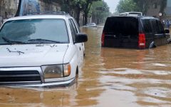
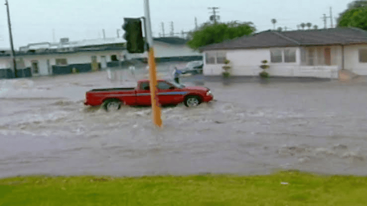
The advisory extension comes in the wake of weekend thunderstorms and severe hail that triggered flash floods across the eastern Las Vegas Valley, resulting in one fatality and multiple emergency water rescues along the Lake Mead Parkway corridor in Henderson.
+--------------------------------------------------------+
|          NORTHEAST CLARK COUNTY FLOOD WATCH DOSSIER    |
+--------------------------------------------------------+
|  - Issuing Agency: National Weather Service (VEF)      |
|    Las Vegas Forecast Office                           |
|  - Geographic Scope: Northeastern Clark County, Lake   |
|    Mead Basin, Lincoln County & Regional Corridors     |
|  - Duration: In Effect Through Late Sunday Night       |
|  - Anticipated Rainfall: 0.50 to 1.00+ Inches Localized|
|  - Soil Condition: Fully Saturated Post-Storm Ground   |
|  - Primary Hazards: Rapid Sheet Flooding, Washes       |
|    Running Full, Low-Water Crossing Submersion         |
|  - Historical Context: Pushed Monthly Total to 1.22",  |
|    Tying 2nd-Wettest October in Las Vegas History      |
|  - Public Directive: Turn Around, Don't Drown (NWS)    |
+--------------------------------------------------------+
Excessive Runoff Risks in Washes and Low-Water Crossings
Meteorologists emphasized that because weekend cloudbursts dropped up to 1.5 inches of rain on urban neighborhoods—tying October as the second-wettest on record for the valley—even modest precipitation is incapable of soaking into the soil.
Instead, immediate surface runoff is funneling into concrete flood channels, drainage culverts, and normally dry desert arroyos.
“With saturated soils and significant runoff expected, flash flooding can develop rapidly even during periods of light or moderate rain,” NWS forecasters stated in technical bulletins.
The primary areas of concern include low-water crossings near Moapa, Glendale, the Overton wash system, and eastern highway access points leading toward Lake Mead and the Valley of Fire corridor.
Regional emergency coordinators noted that runoff will also impact rural road shoulders along Interstate 15 and State Route 169, where standing water and accumulated mud create hydroplaning hazards for freight and passenger motorists.
Safety Directives and Valley Emergency Response
Municipal emergency departments and Clark County Public Works crews are monitoring retention basins across the regional flood control network, clearing debris grates choked with gravel and hail washouts.
+--------------------------------------------------------+
|             EMERGENCY HYDROLOGY PRECAUTIONS            |
+--------------------------------------------------------+
|  • Low-Water Crossings: Barricades indicate hazardous  |
|    underwater road surfaces; never drive around them   |
|  • Channel Warnings: Flood detention basins fill       |
|    within minutes; keep bystanders clear of washes     |
|  • Drainage Debris: Watch for residual silt, standing  |
|    water, and stalled vehicles on rural access ramps   |
+--------------------------------------------------------+
The National Weather Service urged residents across Clark County to avoid all flood channels, heed roadway barriers, and prepare for temporary highway detours until the atmospheric moisture boundary pushes eastward into Arizona overnight.
Source: National Weather Service Forecast Office Las Vegas Flood Statements (Issued Nov. 1, 2026), Clark County Regional Flood Control District Telemetry, Nevada Department of Transportation Emergency Bulletins.
© 2026 Nevada Globe. All Rights Reserved.


- National Weather Service Extends Flood Advisories Across Northeastern Clark County Through Sunday Night - November 1, 2026
- One Dead, Multiple Rescued After Violent Weekend Flash Floods Sweep Henderson - November 1, 2026
- Fifth Non-Citizen Charged in Federal Crackdown on Illegal Voting in Clark County - October 30, 2026
RELATED ARTICLES
-
 September 14, 2022
-
-
December 14, 2022