Hawk Fire Erupts Near Somersett in Northwest Reno, Triggering Level 3 “Go Now” Evacuations as Structures Face Immediate Threat
By TheNevadaGlobeStaff, August 22, 2026 1:58 pm
RENO, NV — Multi-agency wildland firefighting teams rushed to defend residential subdivisions in Northwest Reno on Saturday after a fast-moving brush fire—dubbed the Hawk Fire—ignited near the Somersett neighborhood, triggering mandatory Level 3 “Go Now” evacuation orders.
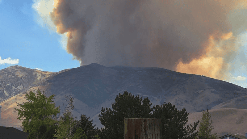
The blaze ignited at approximately 11:25 AM near the Somersett Golf and Country Club, off the Hawk Meadow Trail roughly one mile north of Cold Creek Trail. Fueled by dry cheatgrass, gusty thermal canyon winds, and low humidity, the fire expanded to an estimated 30 to 40 acres within an hour, pushing toward the backside of Peavine Peak and prompting emergency structural protection deployments.
+--------------------------------------------------------+
|             HAWK FIRE EMERGENCY INCIDENT DOSSIER       |
+--------------------------------------------------------+
|  - Incident Name: Hawk Fire                            |
|  - Ignition Time: ~11:25 AM Saturday, August 22, 2026   |
|  - Location: Hawk Meadow Trail / Somersett, NW Reno    |
|  - Estimated Size: 30 to 40 Acres (Rapid Spread Rate)  |
|  - Lead Responders: Truckee Meadows Fire & Rescue,     |
|                     Reno Fire Department, USFS, BLM    |
|  - Evacuation Mandate: Level 3 "GO NOW" for Somersett  |
|    Peak, South Mountain, Sierra Canyon & Peavine Back  |
|  - Preparedness Alerts: Level 2 "SET" along N Virginia |
|  - Structures: Immediately Threatened along Ridgelines |
+--------------------------------------------------------+
Evacuation Zones and Perimeter Map Updates
As heavy plumes of dark gray smoke rose above the Truckee River basin, emergency managers from the Washoe County Sheriff’s Office and Truckee Meadows Fire & Rescue (TMFPD) issued immediate mandatory evacuation directives for subdivisions flanking Peavine Mountain.
The Level 3 “GO” evacuation perimeter encompasses:
-
Somersett Peak and South Mountain neighborhoods.
-
Sierra Canyon and the back ridgelines of Peavine Peak.
-
Residential corridors along Somersett Parkway, Avenida de Landa, and Las Brisas Boulevard.
A Level 2 “SET” advisory was issued for areas south of North Virginia Street and communities bordering Verdi and Mogul, instructing residents to pack emergency kits, stage pets, and remain prepared to depart immediately if wind shifts expand the fire’s western flank.
“While portions of the outer evacuation zones are open terrain, residents in the immediate Somersett foothills must remain alert and heed evacuation orders immediately,” stated the Washoe County Sheriff’s Office. “Please avoid the area to allow heavy emergency vehicles and fire strike teams room to work.”
+--------------------------------------------------------+
|              ACTIVE EVACUATION ALERT LEVELS            |
+--------------------------------------------------------+
|  • LEVEL 3 (GO NOW): Somersett Peak, Sierra Canyon,    |
|    South Mountain, Peavine Peak Backside              |
|  • LEVEL 2 (BE SET): North Virginia St, Verdi/Mogul    |
|    borders, Las Brisas Boulevard corridors            |
|  • ROAD RESTRICTIONS: Avoid Somersett Pkwy & MLK Hwy   |
|    access routes for responder vehicle priority        |
+--------------------------------------------------------+
Air and Ground Suppression Surge
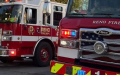
Engine strike teams from the Reno Fire Department, Truckee Meadows Fire, and the U.S. Forest Service deployed structural protection rigs directly into cul-de-sacs along Hawk Meadow Trail. Regional air assets—including single-engine air tankers (SEATs) and water-dropping helicopters—were diverted from regional staging areas to lay retardant lines along steep foothill ridges.
The Hawk Fire breaks out just as Northern Nevada firefighting personnel completed 94% containment on the massive 93,700-acre Bug Fire in northern Washoe County.
Emergency officials urge residents to monitor real-time zone maps on PerimeterMap.com and regional updates via the Watch Duty application.
Source: Truckee Meadows Fire Protection District, Washoe County Sheriff’s Office, Reno Fire Department Incident Command, Watch Duty Wildfire Mapping.
© 2026 Nevada Globe. All Rights Reserved.


- YOUNGKIN TAKES NEVADA: Former Virginia Gov. Talks School Choice With Lombardo, Fires Up Las Vegas Rally - October 23, 2026
- FROM CLASSROOMS TO CAREERS: McMahon Tours Southern Nevada With Buck, Lombardo as Education Fight Heats Up - October 23, 2026
- Cybersecurity Breach at Vendor Compromises Personal Data in SafeVoice Nevada School Safety Tips - October 22, 2026
RELATED ARTICLES
-
 November 24, 2023
 -
February 18, 2023
-