
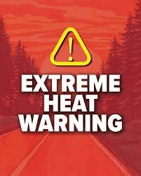
Extreme Heat Continues Across Las Vegas; Storm Chances Rise This Weekend
By TheNevadaGlobeStaff, August 21, 2025 10:42 am
Southern Nevada is currently under an Extreme Heat Warning, which will remain in effect through Saturday evening, according to the National Weather Service. A persistent high-pressure system over the Four Corners region continues to drive temperatures well above average. Today’s high is expected to reach 111 °F, tying the daily record, with highs near 110 °F over the coming days. Overnight temperatures are projected to remain warm, in the upper 80s.
By the weekend, monsoon moisture will begin to influence the region, bringing a return of thunderstorm chances—starting Friday and increasing into early next week. While these storms may bring relief, they also pose hazards such as flash flooding and gusty winds.
Copyright 2025 702 Times, NV Globe. All rights reserved.


- NWS Flood Watch Takes Effect Across Las Vegas Valley as Remnants of Tropical Storm Rachel Menace Mojave Basin - October 10, 2026
- “Operation Loaded Dice”: Federal and Local Task Forces Net 144 Arrests in Expansive Southern Nevada Gang and Narcotics Crackdown - October 10, 2026
- PAYDAY AT THE PUMP: Buck Unleashes $300K-Plus Ad Blitz Hammering Titus on Gas Taxes - October 10, 2026
RELATED ARTICLES
-
 July 14, 2025
 -
September 7, 2022
-
September 7, 2022