
FRIDAY WEATHER FORECAST: SCORCHING HEAT AND SCATTERED STORMS EXPECTED
By TheNevadaGlobeStaff, July 19, 2024 2:35 pm
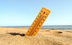
Las Vegas, NV: Las Vegas residents should brace for a sweltering Friday with a mix of sunshine, scattered showers, and thunderstorms. Temperatures are predicted to soar to approximately 111 degrees, nearing the record high of 117 degrees set in 2005.
Excessive Heat Warning in Effect:
An Excessive Heat Warning has been issued for parts of Southern Nevada along the Colorado River Valley, including Lake Mead and Laughlin. The warning, which begins at 10:00 AM Friday and extends through 9:00 PM Sunday, cautions residents to expect dangerously high temperatures ranging from 112 degrees to 118 degrees.
Weather Details:
- Afternoon Storms: While the day will start mostly sunny, expect shower and thunderstorm activity to develop around midday in the mountains and spread throughout the afternoon, potentially reaching the valley.
- Winds: Winds will blow from the southeast at speeds up to 10 mph, with stronger gusts possible in areas experiencing thunderstorms.
- Air Quality & Pollen: Good news for allergy sufferers: air quality is currently ranked “good” and pollen levels are “low” in Clark County.
Friday Night Outlook:
Shower chances will gradually decrease after sunset, leading to mostly clear skies by late evening. Overnight low temperatures in the valley will dip to around 91 degrees with westerly winds up to 10 mph.
The Weekend and Beyond:
High pressure building westward will intensify the heat over the weekend, prompting the expansion of the Excessive Heat Warning to cover most of Southern Nevada. Temperatures are expected to reach between 110 and 115 degrees, with even higher readings possible in Death Valley. Record-breaking temperatures are not out of the question for Las Vegas, where the current records for Saturday and Sunday stand at 113 degrees.
Moisture trapped under the high-pressure system will create the potential for scattered showers and thunderstorms throughout the weekend, particularly in the mountains.
Next Week’s Preview:
A surge of moisture early next week is predicted to increase the chances of showers and storms across the region. Stormy conditions could persist through Thursday, followed by breezy weather and drier air by next Friday. Daytime highs will remain above 110 degrees for most of the week before gradually moderating to 106-107 degrees by the following weekend.
Stay Updated:
Check back for further updates on this developing weather situation. Stay safe and hydrated during this period of extreme heat.
Source: News3LV
Copyright 2024 702 Times, NV Globe. All rights reserved

RELATED ARTICLES
-
 September 7, 2022
 -
December 30, 2022
-